Bay Area Coastal Trail Expansion 2026-2027
Photo by Spencer DeMera on Unsplash
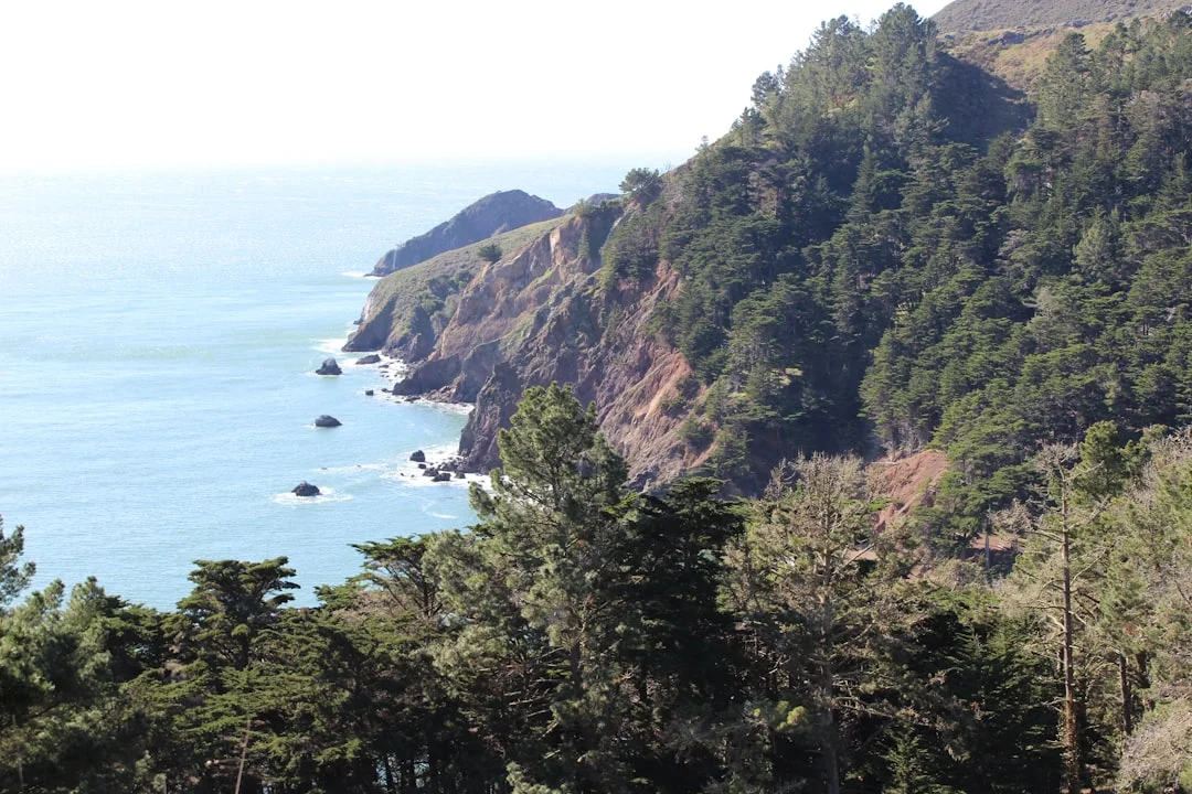
The Bay Area is witnessing a notable push to expand coastal trail networks as part of a broader effort to improve public access to the coastline, integrate adjacent open spaces, and connect urban centers with surrounding natural areas. In early 2026, lawmakers and regional agencies crystallized a plan around the Bay Area Ridge Trail, framing a National Scenic Trail feasibility review and outlining concrete steps to close remaining gaps. This is the first major signal in a coordinated wave of activity that could reshape how residents and visitors experience the Bay Area’s coast and ridgelines during 2026-2027. For readers of the SF Bay Area Times, the unfolding developments center on both legislative momentum and on-the-ground infrastructure work that together would broaden access to coastline views, trails, and shoreline-adjacent recreation. The momentum is complemented by crosscutting Bay Trail projects and a broader ecosystem of regional trail planning that includes the ongoing Bay Skyway concept, which envisions a network that ties together the Bay Bridge corridor with Treasure Island and downtown San Francisco. These interconnected efforts illustrate a data-driven push to expand public access to the Bay Area’s coast and ridgelines, with a timeline that includes key milestones in 2026 and into 2027. (sfchronicle.com)
Beyond the headline news about designation and draft plans, the expansion is rooted in a broader, formal planning framework that tracks miles completed, gaps to fill, and funding progress. For instance, recent reporting highlights that roughly 415 miles of the envisioned 550-mile Bay Area Ridge Trail are already in place as of January 2026, with about 120 gaps remaining to bridge urban crossings, private lands, and challenging terrains. This context matters because it frames the expansion as both an acceleration of ongoing work and a convergence point for local governments, regional agencies, and conservation partners seeking to translate long-range visions into practical, connected routes. The National Scenic Trail designation effort—led by Bay Area lawmakers and supported by the Ridge Trail Council—could, if realized, unlock new funding streams and cross-jurisdiction coordination that help close those gaps more quickly. (sfchronicle.com)
Opening momentum in 2026-2027 also encompasses a broader set of coastal access initiatives that extend beyond the Ridge Trail itself. The Bay Skyway concept, for example, is advancing as part of the Bay Trail network’s cross-bay connectivity strategy. The Metropolitan Transportation Commission (MTC) indicates that Bay Skyway aims to extend the San Francisco-Oakland Bay Bridge East Span Path into a broader, multimodal network connecting Oakland, Treasure Island, and downtown San Francisco. The project envisions an interim West Oakland Link (Phase One) opening in the coming years, with an eye toward long-term connections that would complete a car-free, continuous route across the Bay. Notably, Phase One’s interim elements are targeted for completion by 2029, while the construction of key temporary connections tied to Bay Bridge Forward is expected to begin in 2027 and run through the late 2020s depending on funding and environmental review timelines. This constellation of work reinforces the view that the Bay Area coastal trail expansion 2026-2027 is not a single project but a portfolio of linked initiatives across agencies and municipalities. (mtc.ca.gov)
Section 1: What Happened
Congressional and regulatory momentum to elevate the Ridge Trail
In late January 2026, a bipartisan group of Bay Area lawmakers introduced legislation to designate the Bay Area Ridge Trail as a National Scenic Trail (NST). The introduction triggered a formal feasibility study by the National Park Service, a necessary step before any congressional action could lift the Ridge Trail into NST status. The move, supported by the Bay Area’s nine-county coalition and multiple advocacy partners, would place the Ridge Trail in a national framework alongside a small list of existing NSTs. While not a final designation, NST status would provide a strong governance and funding signal that could accelerate closing remaining gaps and linking segments into a contiguous, interwoven system. The press materials and subsequent reporting framed NST designation as a multi-year process that would begin with a feasibility study, followed by potential legislative action and the development of a comprehensive management plan if designation proceeds. The reporting also underscored the Ridge Trail’s current footprint, noting that approximately 415 miles of the planned 550-mile loop are already in place as of early 2026, with around 120 miles of gaps to address. This milestone both demonstrates substantial progress and highlights the scale of remaining work. The National Scenic Trail initiative’s timing and potential implications drew coverage from major outlets, including the San Francisco Chronicle, which quoted lawmakers and Ridge Trail leaders discussing the designation’s potential to elevate national visibility and support for completing the route. The broader regional coverage emphasizes that NST status would be a catalyst for funding, maintenance, safety improvements, and cross-jurisdiction planning. In short, the Ridge Trail NST effort marks a critical inflection point in 2026 for a regional trail that sits at the intersection of urban life and expansive coastal and ridgeline landscapes. “If approved, NST status would be a major boost for the recreation economy, and our bill gets that ball rolling,” said Rep. Jared Huffman, reflecting the kind of policy leverage proponents anticipate. (sfchronicle.com)
Bay Skyway and the Bay Trail: bridging the coast-to-urban gap
Parallel to the Ridge Trail NST conversation, Bay Skyway is moving forward as a cross-bay connectivity effort within the San Francisco Bay Trail framework. The MTC page on Bay Skyway describes a two-phase plan to extend the Bay Bridge path in both directions: toward West Oakland and east toward Treasure Island and beyond, with the Yerba Buena Island Multi-Use Pathway and West Oakland Link forming key early segments. The initiative is positioned as part of the Bay Trail family and as a stepping-stone toward a more complete, coast-to-center Bay Area trail network. Phase One—Interim West Oakland Link and Interim Yerba Buena Island Multi-Use Pathway—has secured initial funding to advance, including plans to deploy an electric ferry network and a transit-integrated approach to sustaining cross-bay mobility. Importantly, the Bay Bridge Forward component (part of the Bay Skyway family) includes a path across the Bay Bridge West Span, with the environmental analysis and design processes expected to progress through 2027. The Bay Skyway program emphasizes that the full, multi-jurisdictional network could carry thousands of trips and help reduce car dependency in the corridor, aligning with regional climate and resilience goals. (mtc.ca.gov)
Bay Trail Gap Closure Implementation Plan: prioritizing equity and connectivity
The Bay Trail Gap Closure Implementation Plan (BTGCIP), updated in April 2026, spells out priorities to complete the 500-mile Bay Trail network around the bay. The plan consolidates previous analyses that identified missing segments and emphasizes equity, highlighting engagement with Equity Priority Communities and the aim to link employment centers with housing while broadening access to parks and shoreline spaces. The BTGCIP update also reflects sea-level rise considerations and coast-adaptation planning—an acknowledgment that some gaps may require relocation or design adaptations to maintain resilience. The plan is anchored in multi-agency collaboration and public engagement, demonstrating how Bay Area agencies intend to translate long-range trail ambitions into on-the-ground improvements. The final plan is accompanied by a suite of interactive maps and supporting materials that help the public visualize proposed closures and ongoing connectivity work. (mtc.ca.gov)
Contextual backdrop: broader coastal access and data-driven planning
Beyond the Ridge Trail NST and Bay Skyway, the California Coast and Ocean Assessment (2026) provides a statewide context for coastal access planning. The assessment notes that the San Francisco Bay Area has a substantial investment in coastal trail networks, such as the Bay Trail and the Bay Area Water Trail, even as it acknowledges the challenges of capturing Bay Area-specific coastal access data in statewide analyses. The report highlights equity considerations—disadvantaged communities often have less access to the ocean—and calls for better data infrastructures to track coastal access and resilience planning. This backdrop matters for readers seeking to understand how Bay Area coastal trail expansion in 2026-2027 fits into statewide planning and how local projects may benefit from or respond to broader coastal access metrics and climate adaptation requirements. (opc.ca.gov)
Immediate takeaways from the current phase
The convergence of NST feasibility discussions, cross-bay trail connectivity efforts, and gap-closure planning underscores a moment when policy, planning, and on-ground construction are moving in parallel. The NST pathway remains contingent on congressional action and administrative reviews, but even as the NST process unfolds, the Bay Skyway and BTGCIP initiatives are advancing through design, procurement, and early construction phases. The timeline already in view places 2027 as a pivotal year for path extensions tied to the Bay Bridge Forward effort and for the continuation of all phases of Bay Skyway, with more substantial progress anticipated into 2028 and beyond depending on funding and regulatory reviews. The combined effect could be a more integrated Bay Area coastal trail network by 2027, with continued expansion and improvement in subsequent years. (sfchronicle.com)
Section 2: Why It Matters
Expanded access: bringing coast and ridgelines closer to residents
One of the central implications of the Bay Area coastal trail expansion 2026-2027 is greater access to shoreline and ridgeline landscapes for a broad urban population. The Ridge Trail’s NST push explicitly centers the notion of broad accessibility and regional stewardship, suggesting that designation could catalyze improvements in access, maintenance, safety, and land-use planning. The existing Ridge Trail footprint—roughly 415 miles of the planned 550-mile loop by January 2026—demonstrates the magnitude of work already accomplished and highlights the scale of remaining gaps. If NST designation advances, it could accelerate the pace at which these gaps are closed, potentially transforming daily life for hikers, cyclists, commuters, and schools that use the Bay Area’s coastal corridors for recreation and learning. The broader public access argument is reinforced by coverage that frames NST status as a potential “recreation economy booster,” suggesting that increased visitation and longer stays could enrich gateway communities and local tourism ecosystems. (sfchronicle.com)
Economic and tourism implications: a regional growth lens
Beyond access, the coast-to-ridge expansion is positioned to contribute to the Bay Area’s economy. The NST designations, if realized, are commonly associated with enhanced visibility and funding opportunities for trail infrastructure, hospitality services, guides, gear, and related businesses. In coverage of the Ridge Trail’s NST initiative, major outlets emphasized the potential for economic benefits tied to national recognition, while Ridge Trail materials themselves highlighted the route’s capacity to attract new users from across the Bay Area and beyond. The nuance here is important: while NST designation would not instantly fund every segment, it would signal a federal endorsement that could unlock new partnerships and capital, accelerating improvements in trail segments and linking corridors to support small businesses, outdoor recreation operators, and tourism activities along gateway towns. The SF Chronicle’s reporting underscores this economic dimension with quotes from lawmakers and advocates about the potential for funding and market growth tied to national status. (sfchronicle.com)
Equity, resilience, and climate adaptation as guiding principles
The BTGCIP’s emphasis on Equity Priority Communities aligns with a broader, data-driven approach to coastal access that prioritizes historically underserved communities and the connectivity between transit-rich areas and open spaces. The plan’s prioritization criteria—center equity, maximize continuous miles of trail, link employment centers with housing, and increase access to parks—reflect a deliberate attempt to align trail expansion with social and economic equity while recognizing climate resilience. The California Coast and Ocean Assessment adds context by highlighting disparities in ocean access and the need for robust coastal adaptation planning. Taken together, these documents suggest that 2026-2027 will be a period where trail-building efforts are evaluated not only on miles added but on how well they advance equitable access and climate resilience along the coast and bayfronts. (mtc.ca.gov)
Operationalizing connectivity: the Bay Skyway as a catalyst
The Bay Skyway project illustrates how cross-bay connections can catalyze broader network effects for coastal trail expansion. By interlinking the East Bay with Treasure Island and downtown San Francisco via protected bike/pedestrian paths, electrified ferry connections, and dedicated transit corridors, Bay Skyway seeks to create a model for multi-modal, interjurisdictional mobility. The project’s interim milestones—such as the West Oakland Link and interim Yerba Buena Island Multi-Use Pathway—illustrate a pragmatic path forward, generating immediate usability while long-term design and funding arrangements proceed. When integrated with Ridge Trail NST momentum and BTGCIP priorities, Bay Skyway’s progress could accelerate the experience of a seamless Bay Area coastal trail expansion by 2027 and beyond, potentially shaping land-use planning and development around transit-oriented access to the coast. (mtc.ca.gov)
Section 3: What’s Next
Legislative and planning milestones to watch
The NST designation process remains a central hinge for the longer-term trajectory of the Bay Area Ridge Trail. The January 28, 2026 introduction of NST legislation and the National Park Service’s anticipated feasibility study are the first concrete steps in a sequence that could stretch over several years. Observers should watch for amendments authorizing the feasibility study, updates from the National Park Service on scope and timelines, and potential Congressional action to add the Ridge Trail to the National Trails System. Local advocates stress that public engagement, funding commitments, and interagency coordination will be critical to sustaining momentum through the feasibility phase and into later design and implementation phases. The SF Chronicle’s coverage and Ridge Trail Council materials emphasize that NST designation is a multi-year journey, with timelines contingent on legislative calendars and intergovernmental cooperation. (sfchronicle.com)
Construction and funding signals to monitor in 2027
From a more immediate perspective, the Bay Skyway and related Bay Trail projects provide clear 2027 milestones to watch. The Bay Skyway’s Phase One interim west and east connectivities are designed to demonstrate near-term usability, with Bay Bridge Forward components expected to progress in 2027 and continue through subsequent years as funding and environmental analyses mature. This means readers should monitor procurement trends, environmental impact statements, and agency announcements regarding construction start dates and funding allocations in 2027. The MTC page explicitly notes that the Bay Bridge Forward path is tied to the Bay Skyway program and that environmental analyses for Phase Two could be completed by 2027, with full build-out dependent on funding and regulatory approvals. (mtc.ca.gov)
Next steps for readers and stakeholders
For residents, businesses, and travelers, the most tangible near-term steps involve staying informed about Bay Skyway updates, BTGCIP progress, and Ridge Trail NST feasibility developments. Community engagement opportunities, public meetings, and feedback channels will play a crucial role in shaping project prioritization, equity considerations, and design decisions as 2026-2027 unfolds. Local government agencies, planning bodies, and advocacy groups will likely publish regular progress reports and maps illustrating gap closures and interim trail connections. The Bay Area has a long history of collaborative trail development across jurisdictions; the current phase underscores that collaboration as essential to executing a coherent, coast-to-ridgeline network. (mtc.ca.gov)
Closing
The Bay Area’s coastal trail expansion 2026-2027 represents a confluence of policy momentum, cross-border infrastructure work, and equity-focused planning. While NST designation remains contingent on federal action, the parallel advances in Bay Skyway connectivity, gap-closure implementation, and coastline-focused assessments collectively signal a meaningful acceleration of public access to coastlines, ridgelines, and inter Urban-to-rural pathways. As Bay Area agencies align their strategies across multiple corridors and funding streams, readers can expect a more connected network of trails, parks, and shoreline access that contributes to healthier communities, resilient coastlines, and a more dynamic outdoor economy. The coming months will reveal how quickly planners can translate 2026 milestones into 2027 progress, and how this growth translates into everyday use—from casual walks along the shore to multi-day ridge traverses that showcase the Bay Area’s coast-to-city landscape. For ongoing updates, residents and readers should watch Bay Skyway forums, BTGCIP releases, and Ridge Trail NST coverage from reputable regional outlets and official agency channels. (sfchronicle.com)