SAFER Bay Project: East Palo Alto Flood Analysis

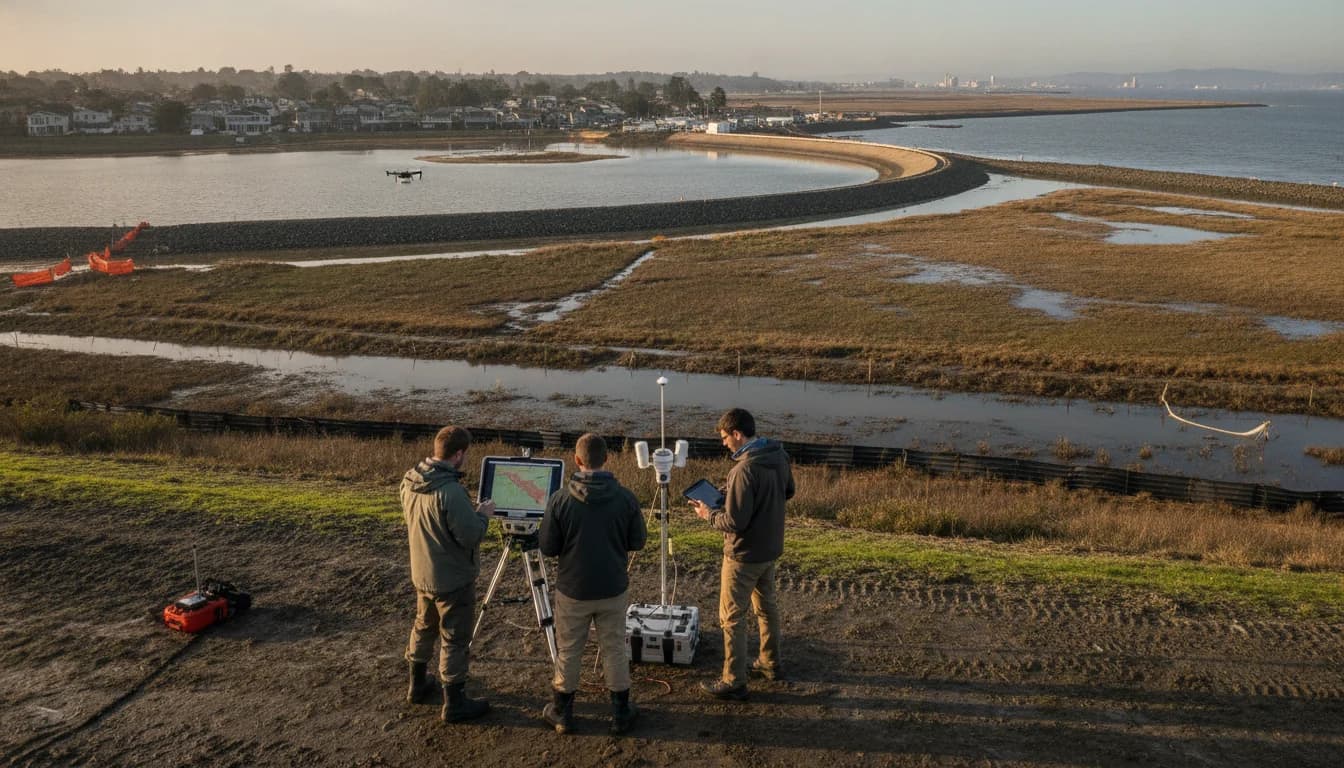
The SF Bay Area Times is delivering a data-driven update on the SAFER Bay Project East Palo Alto Menlo Park flood risk reduction, a comprehensive effort designed to shield communities along seven miles of the San Francisco Bay shoreline. On May 28, 2026, regional authorities certified the Final Environmental Impact Report (FEIR) and approved the SAFER Bay Project, marking a pivotal milestone in a long-running collaboration aimed at reducing tidal flood risk today and preparing for future sea-level rise. The board action, taken by the San Francisquito Creek Joint Powers Authority (SFCJPA), signals a transition from planning and environmental review to permitting, final design, and construction in the earliest phases of a major coastal resilience initiative. As project leaders noted, this milestone brings tangible benefits to East Palo Alto, Menlo Park, and connected infrastructure, while preserving marsh habitat and expanding public access to shoreline amenities. “The community and the environment will benefit from the SAFER Bay Project,” stated an SFCJPA executive during the formal release of the FEIR. (sfcjpa.org)
This news comes as part of a broader Bay Area effort to blend engineered flood protection with natural, habitat-based solutions. The SAFER Bay Project is described as a multi-benefit, multi-jurisdictional undertaking designed to protect homes, schools, utilities, and transportation corridors against current tidal flooding and anticipated sea level rise. The announcement aligns with ongoing design and permitting work, and it confirms the project’s role in a regional resilience strategy that connects to Bay Trail investments and habitat restoration missions. As the SAFER Bay leadership framed it, the approval advances a long-running process that has included extensive public involvement and technical analysis across multiple agencies. (sfcjpa.org)
Opening paragraph: The path forward for flood risk reduction along the EPA/MP corridor is now more defined, with the FEIR approval enabling the next steps in design and permitting. The SAFER Bay Project’s scope—covering roughly seven miles of shoreline in East Palo Alto and Menlo Park—will feature a blend of engineered flood control structures and nature-based improvements, including marsh restoration opportunities that align with regional habitat restoration initiatives. The initiative’s objectives include reducing current tidal flood risk, providing protection from future sea level rise up to 3.5 feet, and expanding recreational access via Bay Trail connections. This integrated approach is intended to deliver both flood protection and environmental restoration, while maintaining strong stewardship of local ecosystems. The decision to certify the FEIR and approve SAFER Bay was accompanied by a formal Notice of Determination filed May 29, 2026, marking a statutory milestone in California CEQA proceedings. (sfcjpa.org)
Section 1: What Happened
The FEIR certification and project approval
A milestone in CEQA review
The SAFER Bay Project proceeded through a rigorous environmental review process under CEQA, culminating in the certification of the Final Environmental Impact Report (FEIR) and formal project approval by the SFCJPA on May 28, 2026. The FEIR and related environmental documents were prepared to evaluate the project’s shoreline protection measures, habitat restoration opportunities, and recreational enhancements along the Bay shoreline spanning East Palo Alto and Menlo Park. The Notice of Determination was filed with San Mateo County on May 29, 2026, initiating the next compliance steps before design and construction can advance. This milestone represents a culmination of years of analysis, public engagement, and agency coordination. (sfcjpa.org)
Project scope and geographic extent
The SAFER Bay Project is described as a multi-benefit, multi-jurisdictional effort designed to reduce flood risks from both current tidal flooding and projected sea level rise along approximately seven miles of shoreline in East Palo Alto and Menlo Park. The initiative is designed to protect critical infrastructure—such as transportation corridors, utilities, and other essential assets—while simultaneously restoring and enhancing shoreline habitat and expanding public access through improved trail connections. This dual focus on resilience and ecosystem restoration situates SAFER Bay within a broader Bay Area strategy that emphasizes habitat-compatible flood protection and community access. (sfcjpa.org)
Timeline highlights and program milestones
- Feasibility studies completed: The SAFER Bay Project began with feasibility assessments completed in 2016 for East Palo Alto and Menlo Park, followed by a separate study in 2019 for Palo Alto. These foundational analyses laid the groundwork for subsequent design and environmental work and were funded through a combination of local and regional sources, including support from Bay Area partners and government entities. (sfcjpa.org)
- Draft EIR and public outreach: The project entered the CEQA process with a Draft Environmental Impact Report (DEIR) published December 2025. Public engagement activities, including outreach meetings and comment periods, accompanied the DEIR preparation, with ongoing community input opportunities highlighted by project partners. The DEIR and related materials were designed to inform residents and stakeholders about proposed flood protection features, habitat restoration options, and recreation improvements. (sfcjpa.org)
- Public meetings and input opportunities: A notable public engagement event occurred on December 15, 2025, when more than 85 residents attended an East Palo Alto SAFER Bay Draft EIR public meeting. In addition, the City of East Palo Alto hosted a later interactive open house on April 16, 2026, to present current designs and gather direct feedback from community members and stakeholders. These dates reflect ongoing efforts to incorporate local perspectives into the project design. (sfcjpa.org)
- FEIR certification and project approval: The FEIR was certified and SAFER Bay Project approval was granted by the SFCJPA on May 28, 2026, with the Notice of Determination filed on May 29, 2026. This sequence marks the formal transition from environmental review into the subsequent phases of permitting, final design, and construction planning. (sfcjpa.org)
Roles of the lead agencies and partners
The SAFER Bay Project is led by the San Francisquito Creek Joint Powers Authority (SFCJPA) on behalf of its member agencies, including the City of East Palo Alto, the City of Menlo Park, the City of Palo Alto, and regional partners such as the San Mateo County Flood and Sea Level Rise Resiliency District and the Santa Clara Valley Water District. The project’s implementation leverages the Bay Adapt Joint Platform and emphasizes collaboration with state, regional, and local agencies to align flood risk reduction with habitat restoration, transportation resilience, and recreation. The SFCJPA has coordinated with Caltrans and other agencies, securing internal funding for early planning steps as part of a staged development process. (sfcjpa.org)
Design and environmental both engineered and natural components
The FEIR documents outline a design approach that combines engineered flood protection features with nature-based solutions, including tidal marsh restoration where feasible to support habitat sustainability alongside flood risk reduction. The project’s approach reflects an emphasis on reducing flood risk while advancing ecological integrity and public access through Bay Trail connections and other shoreline enhancements. The public record emphasizes habitat restoration, water quality improvements, and compatibility with other restoration efforts in the South Bay and Bay Area. (sfcjpa.org)
How the announcement aligns with broader Bay Area resilience efforts
A regional strategy for climate adaptation
The SAFER Bay Project is part of a broader regional effort to adapt to climate change impacts on the Bay Area coastline. By combining flood protection with habitat restoration and recreational enhancements, the project aligns with Bay Area strategies to reduce vulnerability to sea level rise while maintaining ecological and recreational value along the Bay shoreline. The SFCJPA’s alignment with the Bay Adapt Joint Platform underscores an integrated approach to resilience across multiple jurisdictions. (sfcjpa.org)
Public engagement and transparency
From its early phases, the SAFER Bay Project has emphasized public involvement as a core component of decision-making. Notable public meetings, advisory groups, and outreach activities have been part of the process since the Draft EIR stage. The City of East Palo Alto and SFCJPA have scheduled and promoted events to facilitate dialogue between engineers, planners, and residents, ensuring that local concerns and insights inform design considerations. The April 16, 2026 public open house is a recent example of this ongoing engagement. (cityofepa.org)
Section 2: Why It Matters
Local resilience and community protection
Protecting homes, infrastructure, and services
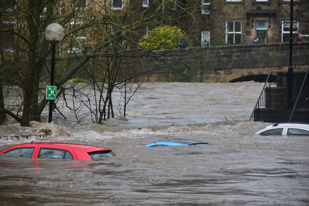
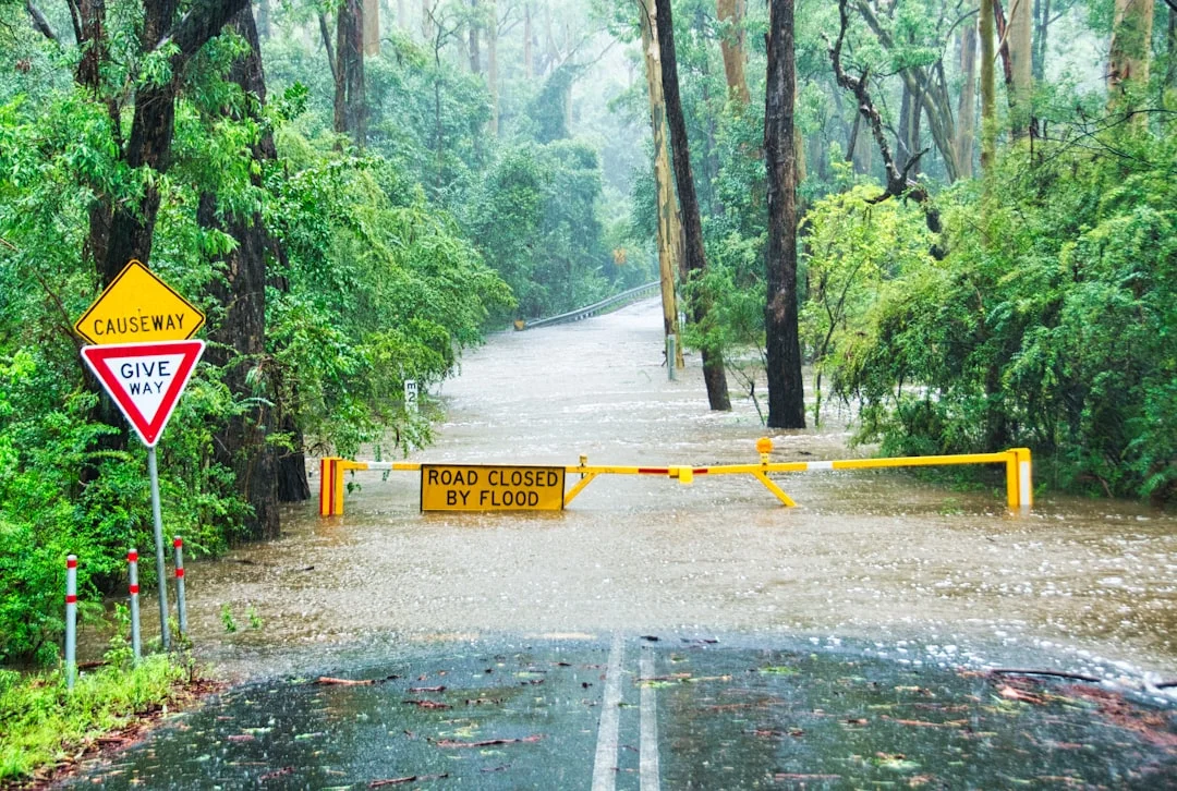
The SAFER Bay Project is designed to reduce the risk of current tidal flooding and provide resilience against future sea level rise for communities in East Palo Alto and Menlo Park. By safeguarding critical infrastructure and housing stock, the project aims to mitigate flood-related disruptions to transportation, utilities, schools, and emergency services. The FEIR and project descriptions emphasize these protective benefits as central to the initiative’s rationale. The FEIR approval signals the transition to design and construction work that seeks to deliver these protections in a timeframe aligned with regulatory processes and community planning. (sfcjpa.org)
Habitat restoration and recreation as resilience multipliers
In addition to flood protection, SAFER Bay emphasizes habitat restoration and trail connectivity as resilience multipliers. The project’s habitat components align with broader restoration objectives in the South Bay Salt Ponds region and with conservation partners, adding ecological value and potential long-term ecosystem services that complement physical flood defenses. Public access improvements and Bay Trail enhancements also contribute to community resilience by strengthening outdoor recreation, promoting stewardship, and supporting local tourism and quality of life. (sfcjpa.org)
Economic and planning context
Budgetary and funding considerations
The SAFER Bay Project’s funding has involved multiple layers, including state grants and local matches. The project’s governance and CEQA process are designed to ensure that funding decisions are informed by environmental review outcomes and community input, with the FEIR serving as a critical reference for permitting and project sequencing. While specific dollar amounts are not disclosed in the public-facing materials summarized here, the project’s financing approach reflects a mix of state, regional, and local sources that support both resilience infrastructure and habitat restoration. (sfcjpa.org)
Interagency coordination and regional impact
The project exists within a network of Bay Area resilience efforts, including coordination with Caltrans, Bay Adapt, and regional planning initiatives. This interagency collaboration is meant to streamline permitting, align with adjacent shoreline projects, and leverage shared knowledge about flood risk reduction and climate adaptation strategies. The SAFER Bay Project’s use of the Bay Adapt Joint Platform and its cross-jurisdictional scope illustrate a broader commitment to scalable solutions that can be adapted to other shoreline segments beyond East Palo Alto and Menlo Park. (sfcjpa.org)
Community experience and access
Public engagement and local knowledge

The ongoing public involvement around SAFER Bay—through meetings, open houses, and advisory committees—reflects a commitment to incorporating community input into design decisions. The April 16, 2026 EPA SAFER Bay Project Open House, in particular, demonstrates a direct channel for residents to engage with engineers and planners, discuss design concepts, and ask questions about timelines and expectations. This engagement is essential for aligning technical decisions with local needs, particularly in neighborhoods prone to flooding or with unique environmental considerations. (cityofepa.org)
Recreation, trails, and access
The SAFER Bay Project’s design framework emphasizes improving shoreline access and recreational opportunities, connecting residents to the Bay Trail and other public spaces. While the primary objective remains flood risk reduction, the added recreational and habitat benefits are presented as integral to long-term community viability, livability, and tourism potential along the East Palo Alto–Menlo Park shoreline. This dual focus is consistent with contemporary urban resilience approaches that seek to balance protection with quality of life enhancements. (sfcjpa.org)
Section 3: What’s Next
Next steps in the SAFER Bay timeline
Permitting, design refinement, and construction planning
With FEIR certification and project approval completed on May 28, 2026, the SAFER Bay Project now advances toward the permitting phase, final design adjustments, and construction planning for the Reach segments in East Palo Alto and adjacent areas. The SFCJPA has indicated that this next phase will involve close coordination among member agencies to secure the necessary permits and finalize design details for the shoreline protection features and habitat restoration components. The project’s published timeline emphasizes a staged progression from environmental review to real-world implementation, with ongoing community input integrated throughout the design process. (sfcjpa.org)
Ongoing public engagement and updates
Public engagement remains a priority as the project moves from planning to execution. The EPA SAFER Bay Project public input channel continues to operate, with upcoming events and informational materials to be announced by the City of East Palo Alto and SFCJPA. Residents can monitor the project’s official pages for meeting notices, design updates, and opportunities to provide feedback on proposed improvements. The April 2026 open house demonstrated the utility of direct conversations between engineers and residents, and ongoing events are anticipated as design work progresses. (cityofepa.org)
What to watch for in the near term
- Permitting milestones and regulatory clearances: Updates on state and local permits, along with any CEQA mitigation monitoring requirements, will shape the pace of final design and construction. The FEIR’s certification and the Notice of Determination set the framework for subsequent regulatory steps. (sfcjpa.org)
- Design refinements and cost updates: As final design progresses, project documents and agency meetings will detail engineering choices, habitat restoration specifics, and cost implications. The SAFER Bay Project’s technical teams and the SFCJPA will publish design-related updates as they become available. (sfcjpa.org)
- Community-informed adjustments: Ongoing outreach efforts and open-house events will continue to shape the project, ensuring local concerns—such as shoreline access, trail routing, and habitat health—remain central to the design process. The April 2026 EPA event demonstrates the type of engagement that will likely recur in the months ahead. (cityofepa.org)
Closing
The SAFER Bay Project represents a substantial evolution in Bay Area flood risk reduction, combining engineering resilience with habitat restoration and public access enhancements along a critical stretch of the East Palo Alto–Menlo Park shoreline. The May 2026 FEIR certification and project approval by the SFCJPA confirm a clear milestone in moving from planning to implementation, while public engagement activities—like the 2025 DEIR process and the 2026 open house—underscore a commitment to transparent, data-driven decision-making. As the project advances into permitting, design, and construction phases, readers should expect a series of updates detailing progress, design choices, and community impacts. For ongoing information, residents can follow the SAFER Bay Project pages hosted by the City of East Palo Alto and the SFCJPA, as well as CEQA documentation and public meeting calendars which continue to shape the project’s trajectory. (sfcjpa.org)
Notes on context and sources
- The SAFER Bay Project is described as a multi-benefit, multi-jurisdictional effort to reduce flood risks from current tidal flooding and future sea level rise along seven miles of shoreline in East Palo Alto and Menlo Park, with involvement from the City of East Palo Alto, the City of Menlo Park, Palo Alto, and regional partners. The FEIR certification and project approval on May 28, 2026, and the Notice of Determination on May 29, 2026, mark a critical transition in the project timeline. (sfcjpa.org)
- Feasibility studies completed in 2016 (East Palo Alto and Menlo Park) and 2019 (Palo Alto) provided the technical foundation for the project’s CEQA process and design work. The Bay Adapt Joint Platform has been cited as a methodological framework for implementing SAFER Bay. (sfcjpa.org)
- The CEQANet pages outline the project’s objective to reduce current tidal flood risk and provide protection from up to 3.5 feet of future sea level rise, along with habitat restoration and recreational enhancements. The NOP and DEIR milestones establish the sequence of regulatory steps and public involvement that informed FEIR documentation. (ceqanet.lci.ca.gov)
- Public engagement events, including the December 15, 2025 SAFER Bay Draft EIR public meeting in East Palo Alto and the April 16, 2026 interactive open house in East Palo Alto, illustrate the ongoing commitment to community input throughout the design and approval process. (sfcjpa.org)
Cited sources (selected)
- SFCJPA Board Certifies Final Environmental Impact Report and Approves SAFER Bay Project. May 28, 2026. San Francisquito Creek Joint Powers Authority. (sfcjpa.org)
- Strategy to Advance Flood Protection, Ecosystems and Recreation along SAFER Bay Project. NOP and project descriptions, CEQA documents. December 2025 DEIR timeline and 2022 NOP. California CEQA Office/CEQANet. (ceqanet.lci.ca.gov)
- SAFER Bay Project overview and FEIR details. San Francisquito Creek Joint Powers Authority. (sfcjpa.org)
- EPA SAFER Bay Project: Public input event and design discussions. City of East Palo Alto. April 16, 2026. (cityofepa.org)
- East Palo Alto City Public Works: SAFER Bay Project page (current status and project scope). City of East Palo Alto. (ci.east-palo-alto.ca.us)