
Skyline Watershed Ridge Trail Opens to Public
Skyline Watershed Ridge Trail opens a six-mile Peninsula segment, expanding the Bay Area Ridge Trail network with data-driven context.
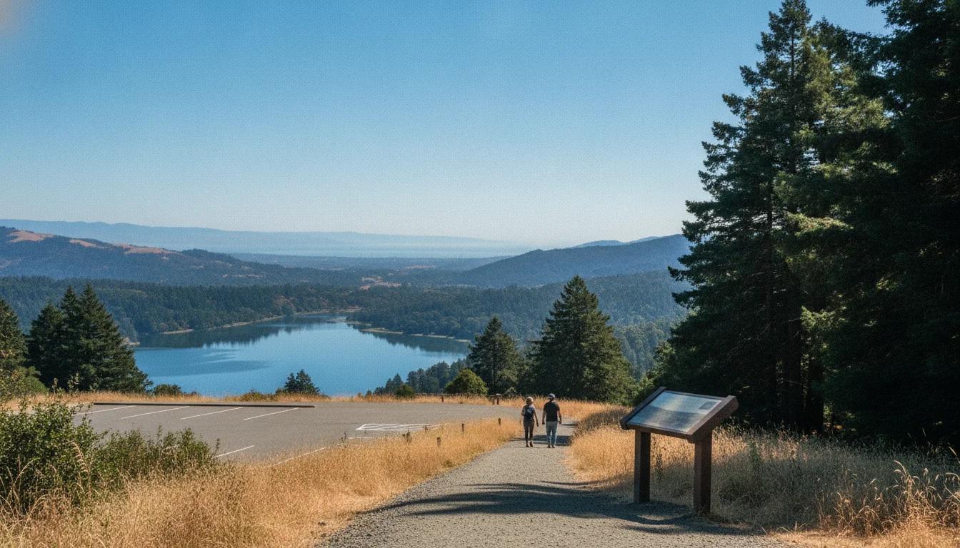
Hiking and outdoor-access analysts, policymakers, and Bay Area residents woke up to a new chapter in local recreation on August 24, 2026, as Skyline Watershed Ridge Trail opens to the public. The six-mile segment, cutting through the Peninsula Watershed atop Skyline Boulevard, marks a milestone for the Bay Area Ridge Trail network and for how San Francisco manages access to a sensitive water-supply landscape. The opening follows a coordinated effort by the San Francisco Public Utilities Commission (SFPUC) and regional partners to balance recreation with watershed protection. In a press release issued on August 20, 2026, SFPUC announced the official public opening date and highlighted the trail’s role in educating visitors about water infrastructure, habitat, and regional conservation. This development matters for park planning, trail networks, and the growing demand for sustainable, permitted access to restricted public lands. The SFPUC notes that six miles of new trail are now part of the Bay Area Ridge Trail, expanding a 550-mile network that spans nine Bay Area counties. The practical effect for readers: a new avenue for hikers, cyclists, and equestrians to experience San Francisco’s watershed lands without compromising drinking-water protection. The official opening date—Monday, August 24, 2026—was clearly stated by SFPUC in the release, positioning Skyline Watershed Ridge Trail opens as a timely case study in public access to sensitive infrastructure. (sfpuc.gov)
According to SFPUC’s August 20, 2026 release, the Skyline Watershed Ridge Trail opens on Monday, August 24, 2026, adding six miles to the Bay Area Ridge Trail and lifting the regional network to 413 miles from a prior total of 407 miles (a roughly 1.47% increase). (sfpuc.gov)
Section 1: What Happened
Announcement and Opening Day details
The SFPUC publicly announced the Skyline Watershed Ridge Trail opens on Monday, August 24, 2026, providing access to a six-mile segment running parallel to Skyline Boulevard on SFPUC property. The press materials describe the trail as an out-and-back route with a six-foot-wide, all-weather surface designed to accommodate hikers, runners, cyclists, and equestrians alike, with grades that offer both gentler sections and more challenging climbs. The press release emphasizes that permits are required for entry and that parking is limited but available at the northern trailhead. The combination of a formal opening date and the official permit framework makes Skyline Watershed Ridge Trail opens a notable test case for public access to restricted watersheds. The SFPUC notes that these access controls are designed to protect water quality while still enabling recreational use. The release also situates the trail within the broader Bay Area Ridge Trail system, adding a new six miles to the regional network and aligning with Bay Area Ridge Trail Council goals. (sfpuc.gov)
Trail geography, length, and design specifics
The Skyline Watershed Ridge Trail extends six miles south from Highway 92, offering views of Crystal Springs Reservoir, the Pacific Ocean, and Bay Area landscapes that vary from grassland to coastal scrub, Douglas fir forest, and redwood groves. The trail’s design prioritizes environmental stewardship, with interpretive panels along the route to educate visitors about watershed history, habitat, and water infrastructure. The route is described as a multi-use path suitable for walking, running, and cycling, with an ADA-friendly component in the associated Watershed Discovery Trail that runs near the northern segment. The Watershed Discovery Trail is a half-mile, disability-accessible path located adjacent to the Fifield-Cahill Ridge Trail north of Highway 92, designed to meet accessibility standards while connecting visitors to watershed science through tactile models and interpretable signage. These elements reflect a broader strategy to reconcile public access with watershed protections. (sfpuc.gov)
Permits, hours, and access logistics
A core feature of Skyline Watershed Ridge Trail opens is the permit regime. SFPUC established free annual permits required for entry, with enrollment enabling year-round use for the calendar year. The trail gates operate from 6 a.m. to 6 p.m. daily, and the northern trailhead includes parking for 22 standard vehicles, five trailer spaces, and two accessible spaces. The SFPUC FAQ offers practical guidance, including parking logistics, the six-mile distance (one-way; 12 miles round trip), and the fact that no direct crossing of Highway 35 or 92 exists at this time. The FAQ also clarifies that dogs are not allowed, and that the trail remains an out-and-back route without connections to neighboring parks for the time being. The combination of a strict permit system and designated hours is intended to protect the watershed while accommodating diverse trail uses. (sfpuc.gov)
Public education and interpretive features
In addition to access, Skyline Watershed Ridge Trail incorporates interpretive panels intended to illuminate watershed biology, water infrastructure, and regional history. The SFPUC press materials highlight the interpretive panels as a key feature of the experience, intended to educate the public about the Peninsula Watershed’s role in the Hetch Hetchy water system and the importance of water quality. The trail design also includes mile markers to help visitors gauge progress and understand the landscape’s ecological diversity. The Watershed Discovery Trail complements the main Ridge Trail by offering an accessible route that demonstrates inclusive design while showcasing watershed science for visitors with disabilities. (sfpuc.gov)
Impact on the Bay Area Ridge Trail network
The SFPUC release frames Skyline Watershed Ridge Trail opens as a strategic expansion of the Bay Area Ridge Trail network, adding approximately six miles to the regional system and pushing the total to around 413 miles. The release emphasizes coordination with the Bay Area Ridge Trail Council to integrate this new segment into the broader network and to ensure that public access aligns with watershed protections. The addition is presented as a milestone in connecting the Peninsula watershed lands with the Bay Area Ridge Trail’s evolving route across multiple jurisdictions, reflecting a broader trend toward regional collaboration on trail connectivity. (sfpuc.gov)
Section 2: Why It Matters
Public access balanced with water protection
Skyline Watershed Ridge Trail opens at the intersection of outdoor recreation and essential water infrastructure. The Peninsula Watershed stores water that serves millions in the Bay Area, and the SFPUC notes that access to such lands requires careful management to preserve water quality. The new six-mile segment illustrates how agencies can expand public access while maintaining robust protections for sensitive habitats, water supply reliability, and watershed stewardship. As Tim Ramirez of SFPUC’s Natural Resources and Lands Management Division told Chronicle reporters during a private tour cited in the Chronicle piece, the goal is to “tell our story” about the watershed while minimizing treatment costs and safeguarding water quality. This dual objective—recreation and protection—frames Skyline Watershed Ridge Trail opens as a case study in modern public land management. (sfchronicle.com)
Community impact: visitors, local economies, and park access
The trail’s opening is expected to influence local recreation patterns, particularly during weekends when parking can be crowded. The SFPUC warns that parking at peak times can be tight and encourages visitors to consider weekday visits or alternative nearby trails. This anticipates a shift in visitor flows within the Bay Area Ridge Trail system, potentially redistributing demand across adjacent preserves such as Purisima Creek Redwoods Open Space Preserve and Fifield-Cahill Ridge Trail. The public-permit model adds a layer of user accountability that can shape how communities engage with watershed lands—favoring responsible usage and education over unregulated access. Local officials, including San Mateo County supervisors quoted in the SFPUC release, emphasize the value of the Peninsula Watershed for both its ecological significance and its role in regional water security. (sfpuc.gov)
Technology-enabled access and information dissemination
The Skyline Watershed Ridge Trail opens also reflect a trend in using technology to manage access and information flow. The SFPUC’s permit system is administered online, and the agency provides digital trail maps, online permit enrollment, and a set of trail signs that convey watershed science in multiple formats. The press release highlights the online permit process as a straightforward way for residents and visitors to register, which reduces friction in accessing the trail while enabling the agency to monitor visitation patterns. The combination of digital permits, interpretable signage, and structured hours aligns with a data-driven approach to balancing public use with environmental stewardship, a model other public lands agencies are likely to study. The Chronicle’s reporting underscores the importance of visitor behavior and the need to monitor user conduct as trails open to broader public access. (sfpuc.gov)
Broader context: trail networks and regional planning
Skyline Watershed Ridge Trail opens as part of a longer arc of Bay Area trail expansion. The Bay Area Ridge Trail Council has been working for decades to connect ridgelines around the Bay, and the new Peninsula segment represents a tangible step in advancing that mission. The Ridge Trail’s multi-county scope means decisions at the SFPUC level—such as permitting, parking, and accessibility—have implications beyond San Mateo County. The new six-mile segment not only diversifies recreational options for residents but also helps demonstrate how natural resource agencies can partner with nonprofit trail councils to realize large-scale infrastructure and conservation goals. The SFPUC’s press materials and the Chronicle’s reporting highlight the collaborative nature of this effort, as well as the ongoing work to plan future connections to Purisima Creek Redwoods Preserve and other Bay Area Ridge Trail components. (sfpuc.gov)
Who benefits and who is affected
The immediate beneficiaries are hikers, trail runners, cyclists, and equestrians who gain a new route with scenic vistas and interpretive context. Another set of beneficiaries includes watershed stewards and researchers who can observe how new public access interacts with habitat and water quality. On the other side, land-use managers face increased responsibilities to ensure that the permit system is enforced, trash and waste are managed, and sensitive habitats remain protected under a changing visitation regime. The Bay Area Ridge Trail Council and local officials emphasize that the Ridge Trail’s expansion strengthens regional connectivity, a factor that can influence property values, local tourism, and community identity around the Bay Area’s natural assets. The SF Chronicle’s reporting underscores a nuanced perspective: while expanded access is broadly welcomed, it also brings attention to potential unintended consequences such as crowding, trail erosion in sensitive zones, and the need for ongoing maintenance. (sfchronicle.com)
Section 3: What’s Next
Future connectivity and planning
The Skyline Watershed Ridge Trail opens a potential pathway for future connections that could link to Purisima Creek Redwoods Open Space Preserve to the south and other segments of the Ridge Trail network. The SFPUC has indicated that a future connection to Purisima Creek Redwoods Preserve North trailhead is in planning stages, though not yet funded or finalized. The Bay Area Ridge Trail Council and regional planning groups will likely monitor how the new six miles integrate with the broader network, including any proposed overpass or crossing improvements to facilitate safe pedestrian and bicycle movement across Highway 92 or Highway 35. These conversations align with ongoing regional discussions about trail safety, access equity, and the balance between public use and watershed protection. The press materials hint at a multi-year horizon for additional connections, with the possibility of new spur trails or cross-jurisdictional links as funding and environmental reviews allow. (sfpuc.gov)
Operational and management plans
The Skyline Watershed Ridge Trail opens under a management regime designed to be sustainable and scalable. This includes ongoing monitoring of trail conditions, maintenance planning to address erosion and vegetation management, and periodic evaluation of the permit system’s effectiveness in distributing visitation across the watershed landscape. The Watershed Discovery Trail’s accessibility features and interpretive panels will require ongoing updates to reflect new science and visitor feedback. In the weeks and months following opening, agency staff will likely publish observational reports, share results about user demographics and behavior, and refine parking and traffic management based on observed demand. The Chronicle’s coverage and subsequent local reporting will likely track these changes, offering a data-driven narrative about how the trail performs as a public asset over time. (sfchronicle.com)
What to watch for in the near term
Key watchpoints include (1) parking utilization and traffic management at peak hours, (2) the effectiveness of the annual permit system in guiding visitation, (3) wildlife and habitat responses to increased foot and bike traffic, and (4) progress on planned future connections that could harmonize the Peninsula Watershed with other Bay Area Ridge Trail segments. Observers should monitor SFPUC updates to the Skyline Watershed Ridge Trail page and any Bay Area Ridge Trail Council announcements about connectivity initiatives or new trail segments. The SFPUC FAQ provides ongoing guidance for visitors, while the press release outlines the broader strategic significance. Together, these sources offer a framework to assess Skyline Watershed Ridge Trail opens against the Bay Area’s broader public-access and watershed-protection goals. (sfpuc.gov)
Closing
Skyline Watershed Ridge Trail opens to Public marks more than a new six-mile hiking option; it signals an evolving approach to public access in restricted watershed lands. The trail’s opening demonstrates how a coordinated, data-informed strategy—supported by permits, education, and careful land-management practices—can expand recreation opportunities while sustaining the integrity of water supply systems. For Bay Area residents and visitors, Skyline Watershed Ridge Trail opens a new lens on how we experience the region’s landscape: a place where outdoor ambition meets careful stewardship, and where innovative public engagement helps translate complex infrastructure into accessible, meaningful experiences. To stay updated on trail conditions, permit changes, and future connections, readers should consult SFPUC’s Skyline Watershed Ridge Trail resources and follow regional trail updates from the Bay Area Ridge Trail Council and local park agencies. (sfpuc.gov)
The Bay Area’s outdoor community now has a fresh corridor that spans habitat, watershed science, and recreational opportunity. As other trail projects evolve, Skyline Watershed Ridge Trail opens provides a benchmark for how people can interact with protected lands—responsibly, informed by data, and with the long view of protecting one of the region’s most vital natural resources. For those planning a visit, the plan is simple: review the permit requirements, be mindful of the six-to-six access window, and enjoy the unique vantage of a landscape that sustains millions while inviting exploration and learning. SFPUC’s guiding documents, public updates, and the Watershed Discovery Trail will be central references as the Bay Area continues to expand its regional trail network in the years ahead. (sfpuc.gov)