Bay Area Coastal Resilience: 2026 Projects & Funding

Photo by Maksym Kaharlytskyi on Unsplash
The Bay Area is stepping up its coastal protection efforts in 2026, with a broad set of announced projects, funding shifts, and cross-jurisdictional collaborations designed to fortify communities against rising seas and extreme weather. The year is shaping up as a watershed moment for Bay Area coastal resilience, as regional agencies, city governments, and private partners align around a shared timetable and a suite of technologies that blend traditional flood defenses with nature-based solutions, data-driven planning, and accelerated project delivery. The news comes as federal, state, and local authorities push more money and attention toward meshing climate adaptation with economic development, housing, and critical infrastructure. Bay Area coastal resilience 2026 is not a single project but a coordinated, multi-agency agenda that translates sea-level rise projections into tangible protective measures and measurable milestones. (sfbayareatimes.com)
Across the region, key announcements point to a diversified portfolio of protections—from seawall reconstructions and tide gates to enhanced drainage and shoreline restoration—that aim to shorten timelines, lower risk, and create resilient waterfronts that communities can rely on for decades. The Port of San Francisco’ s Downtown Coastal Resilience Project, for example, outlines a staged approach to flood defense and seismic strengthening along the Embarcadero, with concept development slated for 2026 through 2027 and formal agreements with the U.S. Army Corps of Engineers to advance design. The project also emphasizes public realm improvements—public spaces, habitat features, and drainage upgrades—that align resilience with urban vitality and waterfront access. This initiative illustrates how resilience planning is increasingly integrated with urban redevelopment and climate-smart infrastructure. (sfport.com)
At the same time, international practice leaders and local engineering consultancies are detailing feasibility studies that broaden the toolkit for coastal protection. Arup’s leadership of the South San Francisco Shoreline Protection and Connectivity Project Feasibility Study, announced in early 2026, signals a shift toward coordinated shoreline protection that connects mobility, access, and climate resilience. The study is exploring options that bring together mobility corridors, shoreline stabilization, and habitat enhancements, underscoring a trend toward systems-thinking in Bay Area resilience planning. Officials describe sea‑level rise as a defining infrastructure challenge and emphasize the need for integrated solutions that can be implemented in phases. (arup.com)
Meanwhile, local agencies have reached notable milestones on existing flood-defense programs. In Palo Alto, the Tide Gate Project reached a major milestone in February 2026, marking an important step in protecting low-lying neighborhoods around the Palo Alto Flood Basin from tidal flooding and earthquakes. The project’s phases include foundation work and seismic retrofits designed to bolster long-term protection for communities along the Bay shoreline, with ongoing coordination among city, county, and water district partners. (valleywater.org)
Funding dynamics are a central part of the 2026 story. In California, lawmakers and regional advocates have framed 2026 as a year of amplified resilience financing, driven in part by Proposition 4 allocations and state-level resilience initiatives. A March 2026 briefing from a Bay Area senator highlighted the doubling of coastal and bayside resilience funding—bringing total resilience allocations to more than $100 million for projects across the San Francisco Bay Area. The funding increase is intended to accelerate project delivery, unlock private-public partnerships, and support a broader resilience agenda that includes habitat restoration, flood control, and urban design improvements. The funding move is being channeled through the California Coastal Conservancy and related authorities, with additional support from SF Bay Area regional programs. (sd13.senate.ca.gov)
In a broader planning context, ABAG (Association of Bay Area Governments) and its regional partners have continued to advance sea level rise planning, position data-driven dashboards, and coordinate with the Bay Area’s transportation and environmental agencies on resilience investments. ABAG’s resilience initiatives emphasize a collaborative approach—linking municipal plans with statewide funding streams and federal programs—so communities can identify priority projects, align risk reduction with equity, and harness a diversified funding pipeline that includes bonds, grants, and federal programs. The Investment Strategy Dashboard, anticipated to be released in 2026, is designed to connect datasets across agencies and improve project prioritization, funding parity, and performance monitoring. (abag.ca.gov)
A growing governance framework for regional resilience is also taking shape in the form of cross-jurisdictional districts and shared authorities. OneShoreline, a San Mateo County-based regional authority, continues to coordinate multi-jurisdictional efforts to secure resources for coastal flood risk reduction, shoreline restoration, and climate adaptation across multiple cities. The district represents a practical model for coordinating funding, permitting, and implementation across municipal boundaries—a dynamic that is increasingly relevant as resilience needs outpace traditional, single-city budgets. (oneshoreline.org)
Public agencies at the city and county level are similarly advancing resilience planning in parallel with private-sector engagement. The SAFER Bay project in Menlo Park and East Palo Alto—“Strategy to Advance Flood protection, Ecosystems Restoration and Recreation along San Francisco Bay”—is a multi-jurisdictional effort designed to protect neighborhoods while enabling habitat restoration and recreational access. The SAFER Bay initiative is frequently cited as a blueprint for aligning flood protection with community quality of life and long-term waterfront stewardship, underscoring the market-friendly shift toward scalable, multi-use resilience investments. (menlopark.gov)
Section 1: What Happened
Regional Funding and Policy Milestones
Momentum from 2025 into 2026

Photo by Cedric Letsch on Unsplash
- In early 2026, regional policymakers formalized a resilience funding strategy that blends Proposition 4 allocations with federal and local dollars, signaling a long-term commitment to Bay Area coastal protection. The funding increase—publicizing a total around $102 million for resilience across Bay Area programs—was framed as a catalyst to accelerate design, permitting, and construction of high-priority projects. This step is widely viewed as critical to unlocking additional state and federal match opportunities and aligning diverse funding streams with project readiness. (sd13.senate.ca.gov)
Plan Bay Area 2050+ and the Resilience Project List
- The Resilience Project List, integrated alongside Plan Bay Area 2050+ planning efforts, remains central to the region’s prioritization framework. The April 27, 2026 update situates resilience planning within the broader urban-growth context, establishing urgency-based project sequencing and signaling the readiness criteria used to move projects from planning into construction. This framework is designed to streamline approvals, align with funding cycles, and provide a transparent basis for public accountability. (sfbayareatimes.com)
ABAG’s Resilience Initiatives and Data Infrastructure
- ABAG’s resilience work continues to emphasize data-driven decision making. The Sea-Level Rise Regional Planning Initiatives program coordinates with the Metropolitan Transportation Commission (MTC), the Bay Conservation and Development Commission (BCDC), the California Coastal Conservancy, and SFEP (San Francisco Estuary Partnership) to develop a shared dataset and funding roadmap. The Investment Strategy Dashboard expected in 2026 will help link datasets to specific resilience projects, enabling more precise prioritization and faster progress from planning to implementation. (abag.ca.gov)
Key Projects Announced or Underway
Downtown Coastal Resilience Project, Port of San Francisco
- The Downton Coastal Resilience Project represents a flagship effort to combine flood protection with seismic upgrades along the Embarcadero, from the Ferry Building to Pier 9. The project contemplates seawall reconstruction, targeted drainage improvements, and enhancements to Rincon Park and adjacent public spaces. Concept development is planned for 2026–2027, with a formal Memorandum of Understanding to guide collaboration with the U.S. Army Corps of Engineers on the broader San Francisco Waterfront Coastal Flood Study. The emphasis on living shoreline features and habitat-friendly waterfront improvements aligns resilience with urban renewal and waterfront vitality. (sfport.com)
South San Francisco Shoreline Protection and Connectivity Feasibility Study
- Arup’s role in leading the feasibility study for South San Francisco’s shoreline protection underscores a wave of city-scale, mobility-centric resilience planning. The study aims to deliver a coordinated vision that improves shoreline protection while enhancing mobility connectivity and access to waterfront assets. This effort is framed as an example of how resilience and economic vitality can be pursued in tandem, with city leadership positioning sea-level rise as a core infrastructure challenge that requires early-stage feasibility work and cross-disciplinary collaboration. (arup.com)
Palo Alto Tide Gate Project – Milestone Achieved
- The Palo Alto Tide Gate Project achieved a key milestone in February 2026 as Phase 1 wrapped up seismic retrofit and rehabilitation work within the Palo Alto Flood Basin. The project’s progression demonstrates how critical and aging flood-control infrastructure can be modernized to resist both tidal surges and earthquake shaking. The ongoing project sequence includes deep-pile foundation work, retrofit design, and upgrades to interior drainage, signaling a practical approach to coastal resilience in a high-value, densely populated corridor along the Bay. (valleywater.org)
Other Regional and County Initiatives
- OneShoreline’s ongoing multi-jurisdictional planning in San Mateo County continues to influence resilience sequencing, funding alignment, and cross-city cooperation. This agency’s work—coordinating across jurisdictions to secure resources for climate adaptation—illustrates how the Bay Area is moving beyond traditional, single-agency solutions toward a more integrated regional model. (oneshoreline.org)
- The SAFER Bay program in Menlo Park and East Palo Alto exemplifies a practical, multi-use approach to resilience that seeks to connect flood protection with habitat restoration and public access improvements, while advancing the local economy and safeguarding critical infrastructure. The project’s scope and partnership structure reflect a broader market trend toward multi-benefit resilience investments that blend risk reduction with community benefits. (menlopark.gov)
Public-Private and Federal Collaboration
- National and regional agencies are increasingly aligning resources with private sector partners to accelerate delivery. NOAA’s work on coastal resilience—emphasizing nature-based solutions, data-driven risk assessments, and federal support for local adaptation efforts—underscores the national framework that regional Bay Area projects are leveraging. The NOAA emphasis on resilience funding for coastal communities adds credibility to local resilience investments and helps standardize best practices across jurisdictions. (oceanservice.noaa.gov)

Photo by Angus Gray on Unsplash
- California’s state-level guidance and coast-related planning, including the 2026 Coast and Ocean Assessment, provide a macro view of climate resilience needs, risk profiles, and policy directions that inform Bay Area investments. The state’s guidance reinforces the connection between coastal protection, ecosystem health, and sustainable development. This alignment helps ensure that Bay Area projects reflect statewide resilience priorities while addressing local conditions. (opc.ca.gov)
Section 2: Why It Matters
Economic and Infrastructure Impacts
Protecting Assets, Reducing Risk
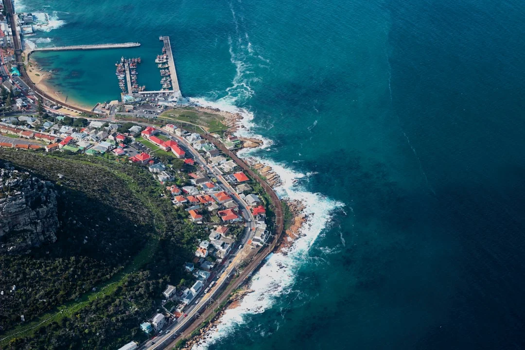
Photo by Max Whitehead on Unsplash
- The expansion of resilience funding and accelerated project schedules aim to safeguard key economic assets along the Bay shoreline, including ports, transit corridors, and downtown waterfronts. By prioritizing projects with high exposure to tidal flooding and storm surge, regional planners hope to minimize disruption to commerce, commuting, and tourism—critical sectors for the Bay Area’s economy. The emphasis on multi-use improvements, such as improving drainage while restoring habitats, helps ensure that flood defenses do not come at the expense of waterfront vitality or habitat integrity. (sfport.com)
The Role of Public-Private Partnerships
- The Bay Area resilience effort is increasingly shaped by public-private collaboration, with private developers, infrastructure firms, and utility operators contributing to feasibility studies, design, and early construction work. The broader funding framework—blending bonds, state and federal grants, and local resources—creates a diversified risk pool and improves the region’s capacity to absorb cost overruns or delays. This market-driven approach can lead to more predictable project timelines and increased investor confidence, which is essential for large-scale coastal improvements that require decades to complete. (sd13.senate.ca.gov)
Equity and Community Impacts
Engaging Communities in Planning
- ABAG and regional partners emphasize equity in resilience planning, aiming to ensure that vulnerable communities receive attention in both funding allocation and project design. The Resilience Project List, with its urgency and readiness criteria, is intended to prioritize projects that deliver the greatest risk reduction for communities most exposed to sea level rise and tidal flooding. In this way, the Bay Area coastal resilience 2026 effort seeks to reduce disparities in flood risk and ensure that resilience benefits are widely shared. (sfbayareatimes.com)
Access, Recreation, and Quality of Life
- Projects like the Downtown Coastal Resilience initiative highlight a broader goal: to reconnect residents with the waterfront through enhanced public spaces, walkable waterfronts, and habitat-friendly infrastructure. By marrying flood defenses with public realm improvements, the Bay Area aims to preserve and even enhance waterfront access and recreational opportunities, which have strong social and economic value for coastal communities. (sfport.com)
Technology and Innovation Drivers
Data-Driven Decision Making
- The 2026 resilience push is as much about data and dashboards as it is about concrete structures. The ABAG-led data initiative and the Investment Strategy Dashboard are designed to integrate risk metrics, funding data, and project readiness, enabling smarter investment decisions and more transparent public reporting. This data-centric approach supports more precise prioritization, helps anticipate funding needs, and improves accountability to taxpayers and stakeholders. (abag.ca.gov)
Nature-Based and Hybrid Solutions
- A notable trend in the Bay Area’s resilience playbook is the use of nature-based features in shoreline defense—such as living shorelines and habitat-enhancing elements—alongside traditional seawalls and flood walls. This hybrid approach seeks to deliver flood protection while preserving or restoring ecological function and providing recreational and educational opportunities for communities. The Port of San Francisco and other projects point toward this blended strategy, signaling a broader market shift toward resilient landscapes that serve multiple purposes. (sfport.com)
Geographic Focus: Hotspots and Highlights
San Francisco Waterfront and Embarcadero
- The Downtown Coastal Resilience Project focuses on critical sectors and neighborhoods along the Embarcadero, an area that combines high economic value with extended exposure to tidal flooding and seismic hazards. The plan’s emphasis on seawall upgrades, drainage improvements, and public realm enhancements shows how resilience investments can be integrated with urban renewal priorities. (sfport.com)
South Bay, Peninsula, and Mid-Bay Corridors
- In the South Bay, Arup’s work in South San Francisco signals a pattern of resilience planning that spans multiple jurisdictions and emphasizes connectivity. The feasibility study’s scope—covering shoreline protection plus mobility and access—reflects a broader trend toward resilience strategies that support both protection and economic activity. (arup.com)
Central and North Bay Initiatives
- Palo Alto’s Tide Gate milestone, Menlo Park–East Palo Alto SAFER Bay, and OneShoreline’s multi-jurisdictional planning illustrate how resilience investments are distributed across the region, addressing local flood risks while coordinating with county and state programs. These efforts underscore the regional scale of Bay Area coastal resilience and the need for synchronized implementation across many communities. (valleywater.org)
Section 3: What’s Next
Near-Term Timeline and Milestones
2026–2027 Milestones
- Expect continued concept development, design milestones, and permitting progress for major projects like the Downtown Coastal Resilience Project and the South San Francisco Shoreline Protection feasibility work. The 2026–2027 window is likely to bring MOU signings, early engineering designs, and the initiation of environmental review processes that set the stage for subsequent construction phases. The coordination with USACE on the San Francisco Waterfront Coastal Flood Study remains a central lever for accelerating federal involvement and funding matches. (sfport.com)
Data and Funding Milestones
- The Investment Strategy Dashboard and related data infrastructure are anticipated to roll out in 2026, delivering new visibility into project readiness, funding gaps, and performance indicators. This dashboard is expected to support prioritization across ABAG’s resilience pipeline and help align funding cycles with project milestones, reducing delay risks and improving stakeholder communication. (abag.ca.gov)
Monitoring, Data, and Market Opportunities
Performance Metrics and Transparency
- With a data-driven approach, Bay Area resilience projects will rely on standardized performance metrics—such as flood attenuation levels, time-to-construction, and economic impact multipliers—to justify funding, track progress, and communicate results to the public. The integration of climate risk data with financing information will enable policymakers to demonstrate the value of resilience investments in tangible, near-term terms. (abag.ca.gov)
Market Signals for Investors and Partners
- The 2026 resilience momentum signals an opportunity for investors and contractors who specialize in climate adaptation, flood defense, and multi-benefit infrastructure. The blend of public funds, bonds, private finance, and federal programs suggests a more mature market environment where resilience projects can attract blended capital, with clear milestones, risk-sharing arrangements, and performance-based contracts. This is a positive feedback loop: successful projects attract further investment, which in turn enables more comprehensive resilience networks. (sd13.senate.ca.gov)
What readers should watch for in the months ahead is the concrete progression of the most visible projects, the speed with which funding streams translate into groundbreakings, and the degree to which data dashboards influence decision making. Bay Area coastal resilience 2026 is intended to be a disciplined, evidence-based push to reduce risk while sustaining the region’s economic vitality and public life along the waterfront. The timeline remains dynamic, but the underlying priority is clear: resilience must be practical, timely, and equitable, balancing engineering rigor with community needs and financial realities. (sfbayareatimes.com)
Closing
As the Bay Area moves through 2026, observers should expect updates from ABAG, MTC, BCDC, and River and Port authorities about new project milestones, funding allocations, and cross-jurisdiction collaboration. The convergence of policy, funding, technology, and public engagement marks a turning point for coastal resilience in the region, with Bay Area coastal resilience 2026 serving as the headline thread that ties together city-level improvements, countywide risk reduction, and state-wide resilience goals. For residents and businesses along the shoreline, the practical implications include more reliable protection from tidal flooding, improved drainage during heavy rainfall, and enhanced waterfront amenities that support housing, commerce, and recreation. Readers can stay informed through official agency updates, local news outlets like SF Bay Area Times, and the ongoing ABAG resilience program, which continues to translate complex risk data into actionable plans for communities across the Bay Area. (onesanfrancisco.org)