
New Six-Mile Skyline Watershed Ridge Trail Opens August 24
SF Bay Area Times reports on the Skyline Watershed Ridge Trail opening and its impact on recreation and watershed stewardship.
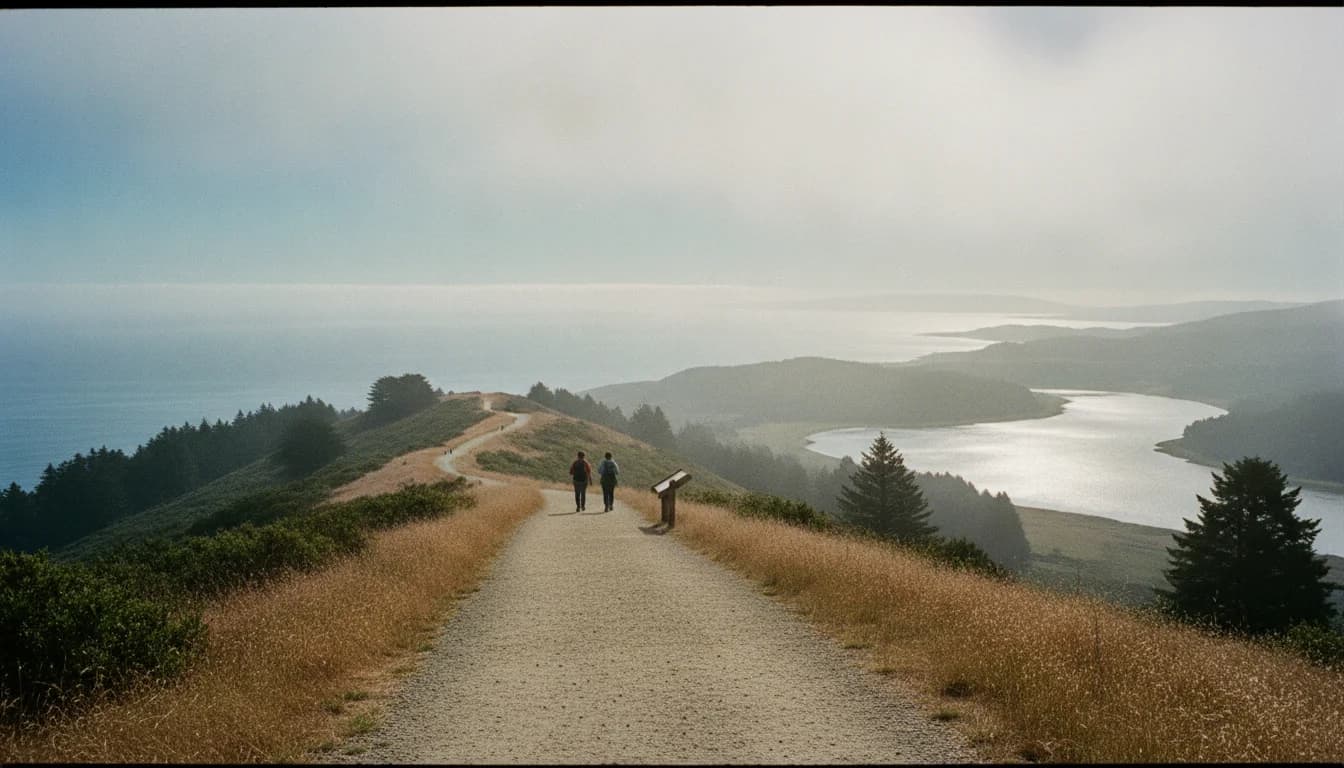
Skyline Watershed Ridge Trail adds six miles of public access and will open on August 24, 2026, according to an SFPUC press release. This landmark development marks a significant expansion of the Bay Area Ridge Trail network and offers a new, publicly accessible perspective on the Peninsula Watershed. The SFPUC press release, issued August 20, 2026, describes the trail as a six-mile out-and-back route along the Peninsula Watershed, parallel to Skyline Boulevard. The opening represents a measured balance between expanding recreational opportunities and preserving essential drinking water infrastructure for the region. The Skyline Watershed Ridge Trail is designed to provide a new gateway to public experiences within a critical watershed, while aligning with ongoing conservation and watershed-management objectives. (sfpuc.gov)
The Peninsula Watershed, located in San Mateo County about 13 miles south of San Francisco, covers 23,000 acres and protects four drinking water reservoirs. It is a cornerstone of the Hetch Hetchy Regional Water System, which serves 2.7 million Bay Area residents and thousands of businesses. As the trail opens, public access is framed within an ecological context that prioritizes both recreation and watershed protection. Ten interpretive panels along the Skyline Watershed Ridge Trail will educate visitors about the watershed’s plants, wildlife, and history, while mile markers help hikers track progress along the six-mile route. The northern trailhead includes free parking and access controls for safe, responsible recreation. (sfpuc.gov)
Local and regional leaders gathered today to celebrate the completion of the Skyline Watershed Ridge Trail, which SFPUC officials say is a key addition to the Bay Area Ridge Trail network. The press release highlights the Ridge Trail’s role in connecting people with one of the Bay Area’s most scenic and protected landscapes, the Peninsula Watershed. In remarks captured by SFPUC communications, Bay Area Ridge Trail Executive Director Janet McBride described the development as a milestone in linking Ridge Trail segments across the Peninsula. The release also features comments from San Mateo County Supervisor Ray Mueller praising the project for expanding access while safeguarding a critical water source. The Ridge Trail is a partnership among public agencies and trail groups designed to expand multi-use, non-motorized access while preserving watershed integrity. (sfpuc.gov)
Opening details emphasize that the Skyline Watershed Ridge Trail runs on SFPUC property parallel to Skyline Boulevard, extending six miles south from Highway 92. The new out-and-back segment adds to the Ridge Trail options in the region and complements the existing 10-mile Fifield-Cahill Ridge Trail north of Highway 92. The Bay Area Ridge Trail Council notes that this addition brings the Bay Area Ridge Trail total to 413 miles, expanding opportunities for hikers, runners, cyclists, and equestrians to traverse ridgelines with sweeping views of reservoirs, coastal scrub, and forest canopies. The trail’s design includes a six-foot-wide, all-weather surface with a mix of level stretches and steeper sections to accommodate a range of outdoor activities. (sfpuc.gov)
What happened in practical terms is straightforward: SFPUC completed a six-mile trail segment through the Peninsula Watershed and opened it to the public with a formal launch. The trail is now part of the broader Bay Area Ridge Trail network, with a focus on balancing open space access with water-supply protections. The press release notes that free permits are required for entry and can be obtained via a simple online application. The trail operates daily from 6 a.m. to 6 p.m., and northern trailhead parking accommodates numerous vehicles, including trailers and accessible entries. This combination of access control and public opportunity reflects a deliberate approach to stewardship that preserves the watershed while inviting community members to engage with the landscape. (sfpuc.gov)
Section 1: What Happened
Announcement and Scope
- The SFPUC issued an official release on August 20, 2026, announcing the opening of the six-mile Skyline Watershed Ridge Trail, which will officially open to the public on Monday, August 24, 2026. The release frames the trail as a major addition to the Bay Area Ridge Trail and a new access point to the Peninsula Watershed. The size of the new segment and the timing of the opening are highlighted as key news for regional recreation and watershed stewardship. The press release provides the official timeline and context for the expansion of public access to Bay Area watershed lands. (sfpuc.gov)
Trail Route and Access
- The Skyline Watershed Ridge Trail runs along SFPUC property parallel to Skyline Boulevard (Highway 35), extending six miles south from Highway 92. It is described as an out-and-back route with mile markers to help visitors gauge progress, and it includes interpretive panels along the way to educate visitors about the watershed. The route provides sweeping views of the Pacific Ocean, San Francisco Bay, and Crystal Springs Reservoir, and it traverses diverse habitats from grasslands to redwood groves. The Bay Area Ridge Trail Council notes that this segment connects with Ridge Trail planning and enhances the Peninsula’s ridgeline experiences. (sfpuc.gov)
Permits, Hours, and Safety
- Entry to Skyline Watershed Ridge Trail requires a free permit obtained online, with the permit remaining valid for the calendar year. Parkers are advised of hours from 6 a.m. to 6 p.m. daily, and the northern trailhead provides parking for a designated number of vehicles, including some trailer spaces. The SFPUC press release underscores that the permit system is part of responsible recreation within a watershed environment, enabling visitors to enjoy the trail while maintaining oversight of public access to water resources. A companion Watershed Discovery Trail north of Highway 92 is also part of the broader project, designed for accessibility and interpretive learning. (sfpuc.gov)
Section 2: Why It Matters
Expanded Access and Connectivity
- The Skyline Watershed Ridge Trail expands the Bay Area Ridge Trail network by adding nearly six miles to the regional system, which is a meaningful increase for Bay Area outdoor recreation. The project aligns with Bay Area Ridge Trail Council goals of circumnavigating the bay with multi-use trail connections and accessible public access. The trail’s addition expands the network’s reach into the Peninsula Watershed, linking visitors with a landscape that has long been protected for municipal water supply. The Ridge Trail, which is designed to span nine Bay Area counties, benefits from high-profile public-private collaboration, and the Skyline Watershed Ridge Trail project serves as a concrete example of how watershed lands can be opened to public enjoyment without compromising water quality or habitat. (sfpuc.gov)
Conservation, Water Security, and Educational Value
- The Peninsula Watershed is central to the Hetch Hetchy Regional Water System, delivering water to millions of residents and supporting regional resilience. The SFPUC emphasizes that the watershed is a protected landscape with ecological value, hosting a variety of habitats and species. The Skyline Watershed Ridge Trail’s interpretive panels and educational components are designed to enhance public awareness of watershed management, conservation challenges, and the role of water infrastructure in regional planning. The press materials frame the trail as a tool for public education and stewardship, linking recreational access with long-term water-security objectives. (sfpuc.gov)
Community and Economic Considerations
- Opening a new trail segment within a watershed can influence surrounding communities by diversifying outdoor recreation opportunities and potentially attracting visitors to San Mateo County. While the SFPUC release focuses on access and stewardship, local officials and regional partners highlighted the broader benefits of a healthier Ridge Trail network—namely, increased awareness of watershed protection, enhanced outdoor recreation capacity, and strengthened regional identity around sustainable land use. The Bay Area Ridge Trail Council’s involvement reinforces the idea that the Skyline Watershed Ridge Trail is part of a broader regional effort to connect public lands and expand trail usage across the Bay Area. (sfpuc.gov)
What It Means for Trail Users
- For hikers, runners, cyclists, and equestrians, Skyline Watershed Ridge Trail represents a new option within a historically protected landscape. The six-mile route is designed to accommodate multiple modes of travel on a relatively even surface, complemented by longer ridge-trail routes north and south that, together, form a more complete Bay Area Ridge Trail experience. The availability of free permits helps manage use levels while maintaining access to a sensitive watershed area. The trail’s design, with interpretive signage, offers educational value alongside physical activity, encouraging responsible recreation and environmental literacy in the same outing. (sfpuc.gov)
Section 3: What’s Next
Future Connections and Ridge Trail Linkages
- The Skyline Watershed Ridge Trail is positioned as a stepping-stone within the Bay Area Ridge Trail network, with ongoing plans to connect Peninsula watershed segments with neighboring ridge segments north and south of the Peninsula. The press release notes alignment with the Fifield-Cahill Ridge Trail north of Highway 92, which already exists as part of the SFPUC’s ridge-trail efforts. The consolidated Ridge Trail network aims to provide continuous, multi-use routes across ridgelines that frame the Bay Area landscape, creating long-term opportunities for exploration and outdoor education. The Ridge Trail Council and SFPUC indicate that the Skyline Watershed Ridge Trail complements existing segments and enhances overall continuity for the regional trail system. (sfpuc.gov)
Maintenance, Monitoring, and Governance
- With any new trail open to the public, ongoing maintenance and environmental monitoring are essential to sustain both recreation and watershed health. The SFPUC’s approach to public access includes regulated hours, online permit systems, and interpretive programming, which together support ongoing stewardship. The public-private collaboration behind the Skyline Watershed Ridge Trail—between SFPUC, the Bay Area Ridge Trail Council, and local jurisdictions—suggests a governance model focused on accountability, accessibility, and ecological integrity. Given the watershed’s role in municipal water supply, periodic reviews and adaptive management will likely shape future improvements or adjustments to access, signage, and trail alignment as needed. (sfpuc.gov)
What to Watch For in the Months Ahead
- Visitors can expect continued updates from SFPUC regarding permits, seasonal access considerations, and any changes to hours or parking. The Ridge Trail Council’s ongoing updates and trail maps will help with planning, while interpretive programming may expand to include additional panels and guided outings. The newly opened Skyline Watershed Ridge Trail will be integrated into broader Bay Area Ridge Trail communications, including events and educational outreach, to maximize public engagement while preserving watershed integrity. Watch for future announcements about connectivity options, potential extensions, and opportunities for docent-led experiences in the Watershed Discovery Trail adjacent to the Fifield-Cahill Ridge Trail. (sfpuc.gov)
Closing
As the Bay Area balances growing demand for outdoor recreation with robust watershed protections, the Skyline Watershed Ridge Trail stands as a practical exemplar of how public lands can be made accessible without compromising water quality. The six-mile addition, the educational panels, and the permit-based access model together reflect a data-driven approach to land management, tourism, and regional resilience. For residents and visitors alike, the trail offers a new way to experience the Peninsula Watershed’s landscapes—from grasslands and coastal scrub to redwood groves—while reinforcing the region’s commitment to sustaining essential water resources for the millions who rely on them daily. The Skyline Watershed Ridge Trail is more than a new path; it is a test case in modern watershed stewardship tied to a broader network of multi-use ridgeline trails that define the Bay Area’s outdoor culture.
To stay updated on Skyline Watershed Ridge Trail developments, visit SFPUC’s Peninsula Trails pages and the Bay Area Ridge Trail Council’s Trail News. The SFPUC’s official materials and the Ridge Trail Council’s updates provide the most reliable, primary-source information about access, permits, and future connectivity plans. (sfpuc.gov)